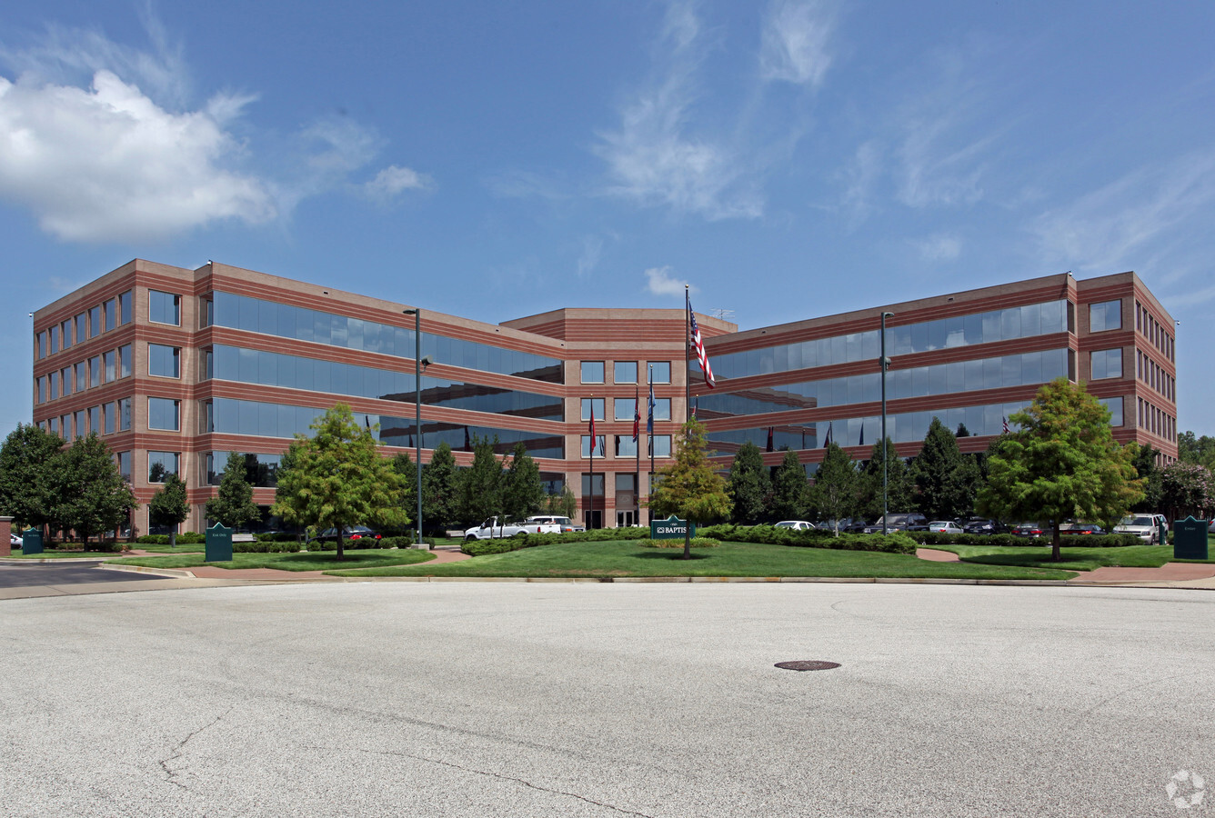
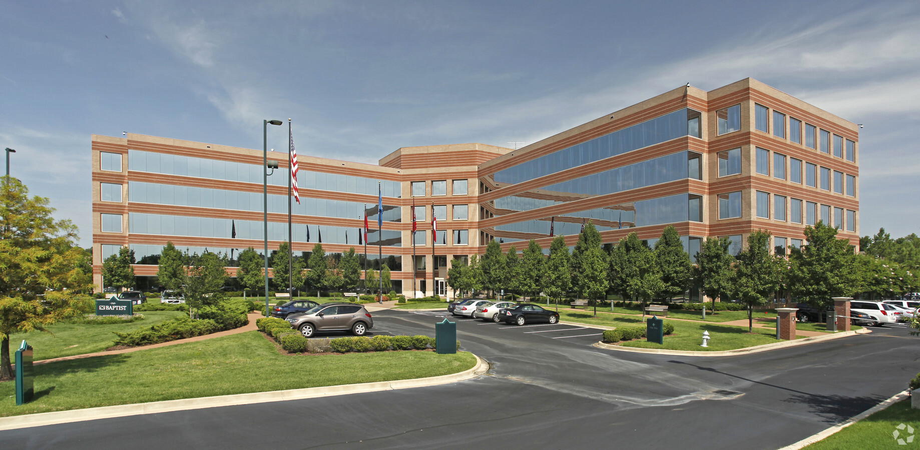
Property Record
350 N Humphreys Blvd, Memphis, TN 38120
NEARBY LISTINGS FOR SALE OR LEASE
Property Detail
350 N Humphreys Blvd
08-0001-0-0021C
Humphreys Center Pd Ph 11
Officebuilding
W END HUMPREYS BLVD SEE MAP G-28 & 29 (TILE# 360)
AE
Shelby
47157C0313G
Tennessee
0
8.43 AC
2024
East
009202
Memphis
85,062 SF
Memphis, TN-MS-AR
DEMOGRAPHICS near 350 N Humphreys Blvd
1 Mile
3 Mile
5 Mile
2024 Total Population
4,231
52,451
198,854
2029 Population
4,125
51,129
194,836
Pop Growth 2024-2029
(2.51%)
(2.52%)
(2.02%)
Average Age
40
40
38
2024 Total Households
1,758
22,732
81,943
HH Growth 2024-2029
(2.67%)
(2.62%)
(2.11%)
Median Household Inc
$120,080
$74,604
$60,157
Avg Household Size
2.40
2.20
2.30
2024 Avg HH Vehicles
2.00
2.00
2.00
Median Home Value
$353,692
$301,748
$236,558
Median Year Built
1967
1972
1972
Nearby Places
- Restaurants
- Banks
- Shops
- Fitness
- Groceries
PUBLIC TRANSPORTATION
AIRPORT
Memphis International
DRIVE
WALK
Distance
Memphis International
22 min
14.1 mi
Freight Ports
Port of Shreveport
DRIVE
WALK
Distance
Port of Shreveport
418 min
384.1 mi
Nearby Properties
Address
Land Use
TOTAL SIZE
Lot Size
Zoning
Address
Land Use
TOTAL SIZE
Lot Size
Zoning
209,070 SF
5.10 AC
RU-3
Address
Land Use
TOTAL SIZE
Lot Size
Zoning
253,002 SF
2.82 AC
CA
Address
Land Use
TOTAL SIZE
Lot Size
Zoning
290,566 SF
2.51 AC
R-15
Address
Land Use
TOTAL SIZE
Lot Size
Zoning
358,595 SF
3.65 AC
R-15
Address
Land Use
TOTAL SIZE
Lot Size
Zoning
104,337 SF
7.30 AC
R-15
Address
Land Use
TOTAL SIZE
Lot Size
Zoning
101,654 SF
6.61 AC
R-15
Address
Land Use
TOTAL SIZE
Lot Size
Zoning
1,082,619 SF
34.67 AC
CMP-1
Address
Land Use
TOTAL SIZE
Lot Size
Zoning
657,276 SF
10.18 AC
OG
Address
Land Use
TOTAL SIZE
Lot Size
Zoning
99,768 SF
100.86 AC
EMP
Address
Land Use
TOTAL SIZE
Lot Size
Zoning
45.85 AC
CA
Address
Land Use
TOTAL SIZE
Lot Size
Zoning
123,976 SF
10.31 AC
CMU-3
Address
Land Use
TOTAL SIZE
Lot Size
Zoning
24.72 AC
R-10
Address
Land Use
TOTAL SIZE
Lot Size
Zoning
63,114 SF
7.13 AC
CA
Address
Land Use
TOTAL SIZE
Lot Size
Zoning
71,673 SF
1.49 AC
OG
Address
Land Use
TOTAL SIZE
Lot Size
Zoning
94,003 SF
7.20 AC
CMU-2
Address
Land Use
TOTAL SIZE
Lot Size
Zoning
347,228 SF
3.56 AC
R-15
Address
Land Use
TOTAL SIZE
Lot Size
Zoning
99,554 SF
3.26 AC
R-15
Address
Land Use
TOTAL SIZE
Lot Size
Zoning
46,216 SF
2.71 AC
CMU-3
Address
Land Use
TOTAL SIZE
Lot Size
Zoning
4,744 SF
19.65 AC
R-15
Address
Land Use
TOTAL SIZE
Lot Size
Zoning
96,768 SF
7.98 AC
OG
Address
Land Use
TOTAL SIZE
Lot Size
Zoning
113,826 SF
29.01 AC
RU-3
Address
Land Use
TOTAL SIZE
Lot Size
Zoning
261,479 SF
5.50 AC
RU-3
Address
Land Use
TOTAL SIZE
Lot Size
Zoning
130,111 SF
5.95 AC
R-15
Address
Land Use
TOTAL SIZE
Lot Size
Zoning
100,182 SF
9.39 AC
CMU-3
Address
Land Use
TOTAL SIZE
Lot Size
Zoning
109,774 SF
8.80 AC
CMU-1
Address
Land Use
TOTAL SIZE
Lot Size
Zoning
77,965 SF
4.89 AC
OG
Address
Land Use
TOTAL SIZE
Lot Size
Zoning
103,252 SF
4.55 AC
OG
Address
Land Use
TOTAL SIZE
Lot Size
Zoning
145,980 SF
16.50 AC
RU-3
Address
Land Use
TOTAL SIZE
Lot Size
Zoning
116,745 SF
10.46 AC
CA
The World's #1 Commercial Real Estate Marketplace
Connect with us
© 2025 CoStar Group
The information above has been obtained from sources believed reliable. While we do not doubt its accuracy we have not verified it and make no guarantee, warranty or representation about it. It is your responsibility to independently confirm its accuracy and completeness. Any projections, opinions, assumptions, or estimates used are for example only and do not represent the current or future performance of the property. The value of this transaction to you depends on tax and other factors which should be evaluated by your tax, financial, and legal advisors. You and your advisors should conduct a careful, independent investigation of the property to determine to your satisfaction the suitability of the property for your needs.